
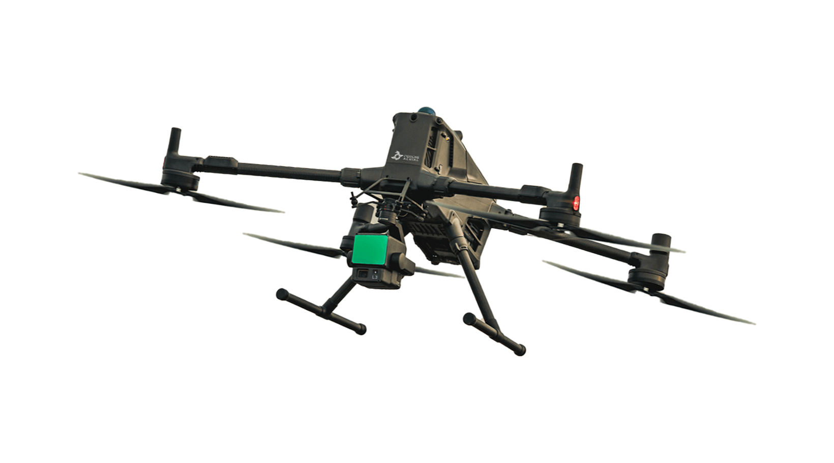
LIDAR SERVICES
Powering these industries:
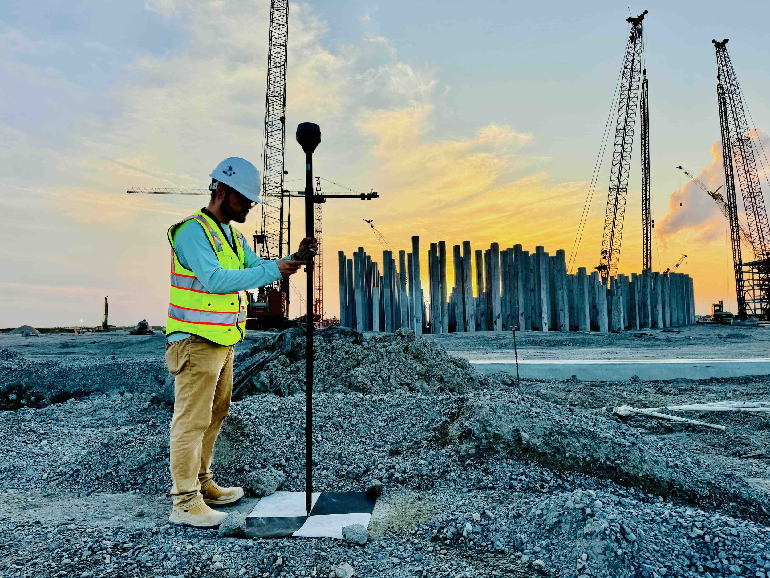
Engineering & Surveying
Environmental Services
Land Development
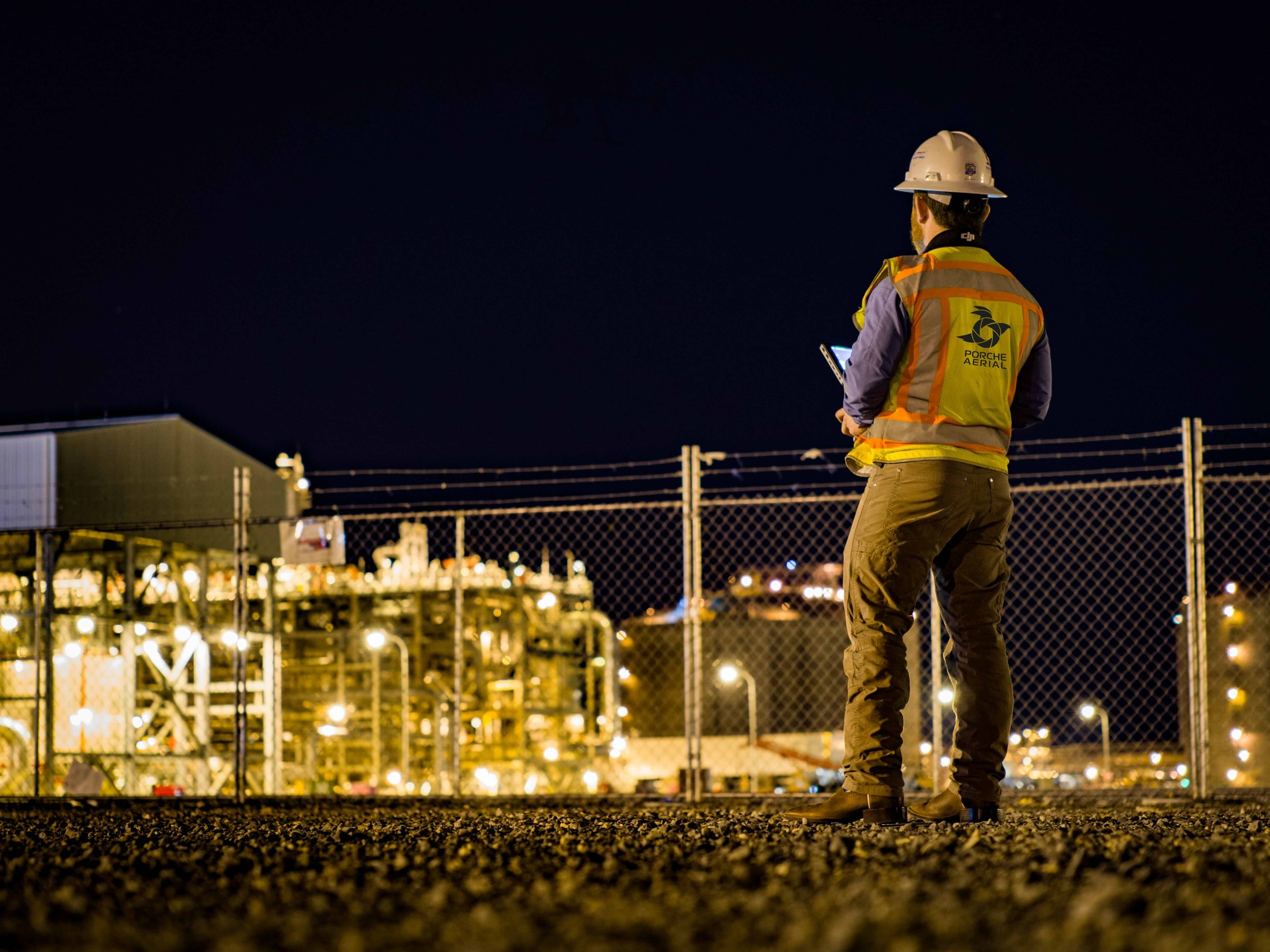
Oil & Gas
Energy & Utilities
Transportation & Infrastructure
Construction & Civil Projects
Government & Municipalities
Telecommunications
WHAT IS LIDAR?
Imagine dropping a ball and timing how long it takes to hit the ground and return to your hand. That timing reveals the distance between you and the surface. This is the basic principle behind LiDAR. Instead of a ball, it uses laser light to collect precise distance measurements from above.
The laser scanning process happens millions of times per second, in every direction, capturing trees, buildings, and terrain. Each returning pulse provides a precise data point, and together they form a highly detailed 3D point cloud of the scanned area.
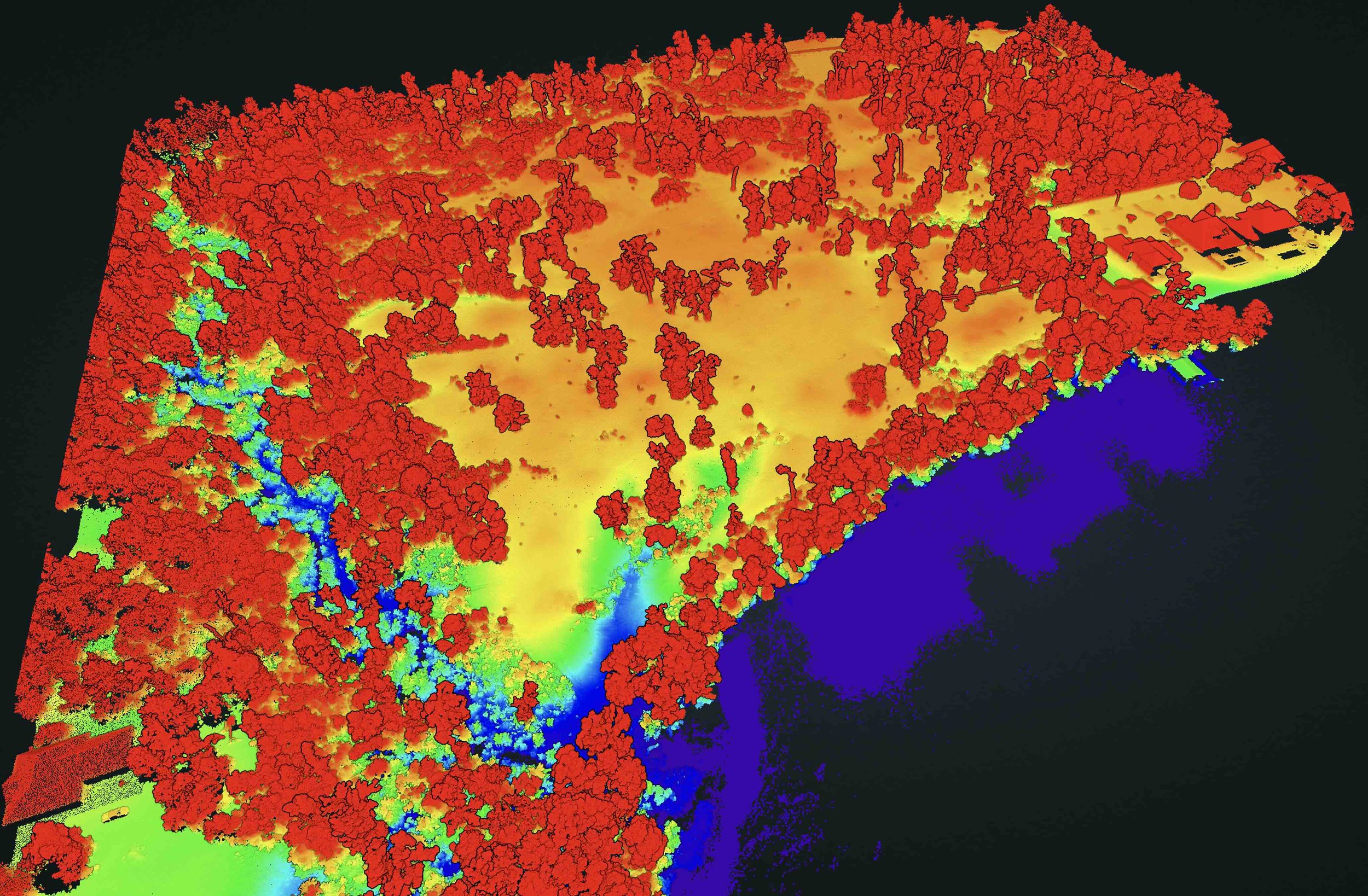
LiDAR (Light Detection and Ranging) is transforming airborne data collection by providing accurate elevation data at scale. One of LiDAR’s most powerful capabilities is its ability to penetrate vegetation. Unlike traditional imagery, LiDAR can map the bare earth beneath thick tree cover, making it invaluable for forestry, flood analysis, and land development. It also plays a critical role in construction and excavation by allowing teams to visualize cut and fill volumes, calculate site balance, and make informed decisions.
Explore the interactive sample below to see the power of LiDAR in action! While traditional methods only capture the tops of trees and vegetation, LiDAR technology allows us to see through the canopy to reveal the true ground surface beneath. This enables a complete and accurate terrain analysis that would otherwise be impossible to achieve.


Multiple
Viewpoints.
One Clear Picture.
The value of a LiDAR scan goes far beyond a single view. Multiple viewpoints enable end-users to extract a wide range of project metrics.
Visible (RGB): High-resolution imagery matched to the terrain for easy interpretation.
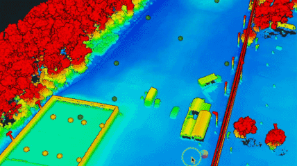
Point Cloud: A dense, 3D dataset showing elevation at every scanned point.
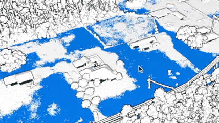
Vegetation Removal: Bare-earth models generated by filtering out trees and brush.
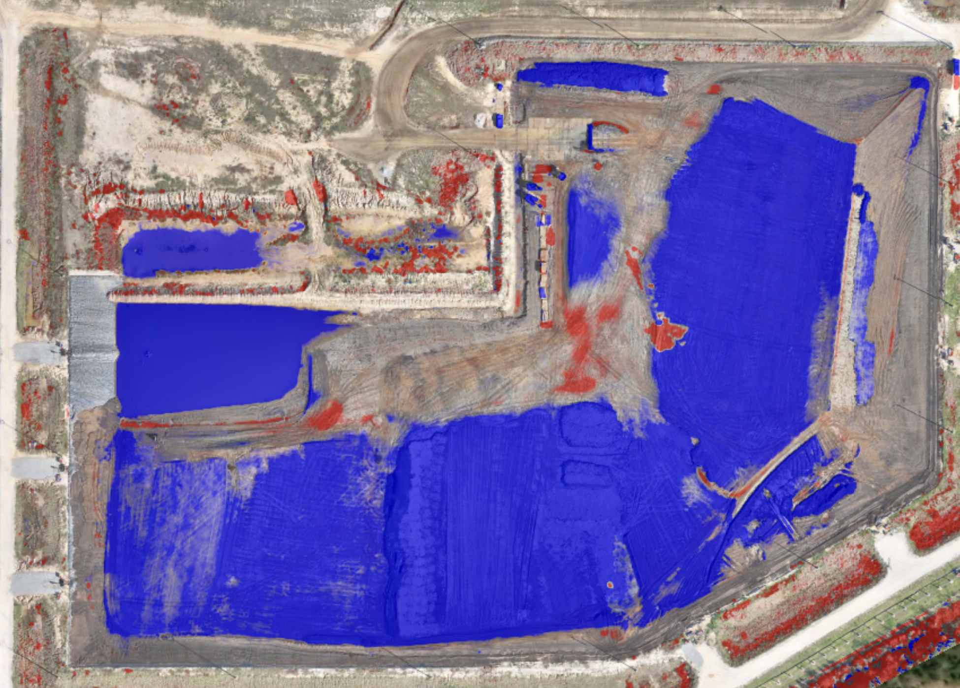
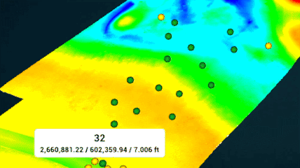
Water Pooling Analysis: Visualization of low-lying areas prone to water accumulation.
This multi-layered output provides unmatched insight for planning, development, and environmental analysis. The following showcases the range of these viewpoints.
FLY above.
SCAN BELOW.
UNLOCK DETAILS.
A clearer view from above. LiDAR gives you precision where it matters most. By using laser pulses to map the ground in high detail, we can reveal elevation data, detect terrain changes, and create 3D models of complex environments. It’s the foundation for smarter decisions in construction, engineering, and land development.
Why LiDAR makes the difference. Traditional methods often miss what lies beneath vegetation or uneven surfaces. Our LiDAR payloads penetrate through trees and clutter to reveal the true ground surface. The result is fast, accurate data collection across large areas with minimal disruption.
Explore the possibilities. The video below highlights how LiDAR supports earthwork planning by providing clear elevation data and accurate terrain models. This process helps teams visualize site conditions, estimate volumes, and make more informed decisions early in the project.
VIDEO: LiDAR + Earthwork
Transforming LiDAR Data into Actionable Insights for Your Project
FIELD APPLICATIONS
-
![Earthwork LiDAR Application]()
Earthwork Verification
Engineering & Construction teams use cut/fill data to detect grading anomalies, confirm proper site prep, and reduce project rework.
-
![Developers LiDAR Application]()
Land Evaluation
Developers use our LiDAR technology to analyze properties to see below vegetation, pinpoint high and low elevation areas, identify potential drainage issues, and perform water pooling analysis.
-
![Real Estate LiDAR Application]()
Real Estate
Soon-to-be homeowners use LiDAR scans prior to closing to assess drainage patterns and identify potential water pooling on adjacent properties. This insight can help anticipate and mitigate future issues.
-
![Survey Assistance LiDAR Application]()
Surveying Assistance
Survey firms operating in remote or large-scale terrain use our services to capture detailed topographic data in areas where traditional crews would be limited by time, access, or safety.
-
![Drainage LiDAR Application]()
Drainage Mapping
We inspect drainage infrastructure for municipalities by scanning canals, ditches, and floodways to support efficient maintenance planning and proactive stormwater management.
-
![Digital Twin LiDAR Application]()
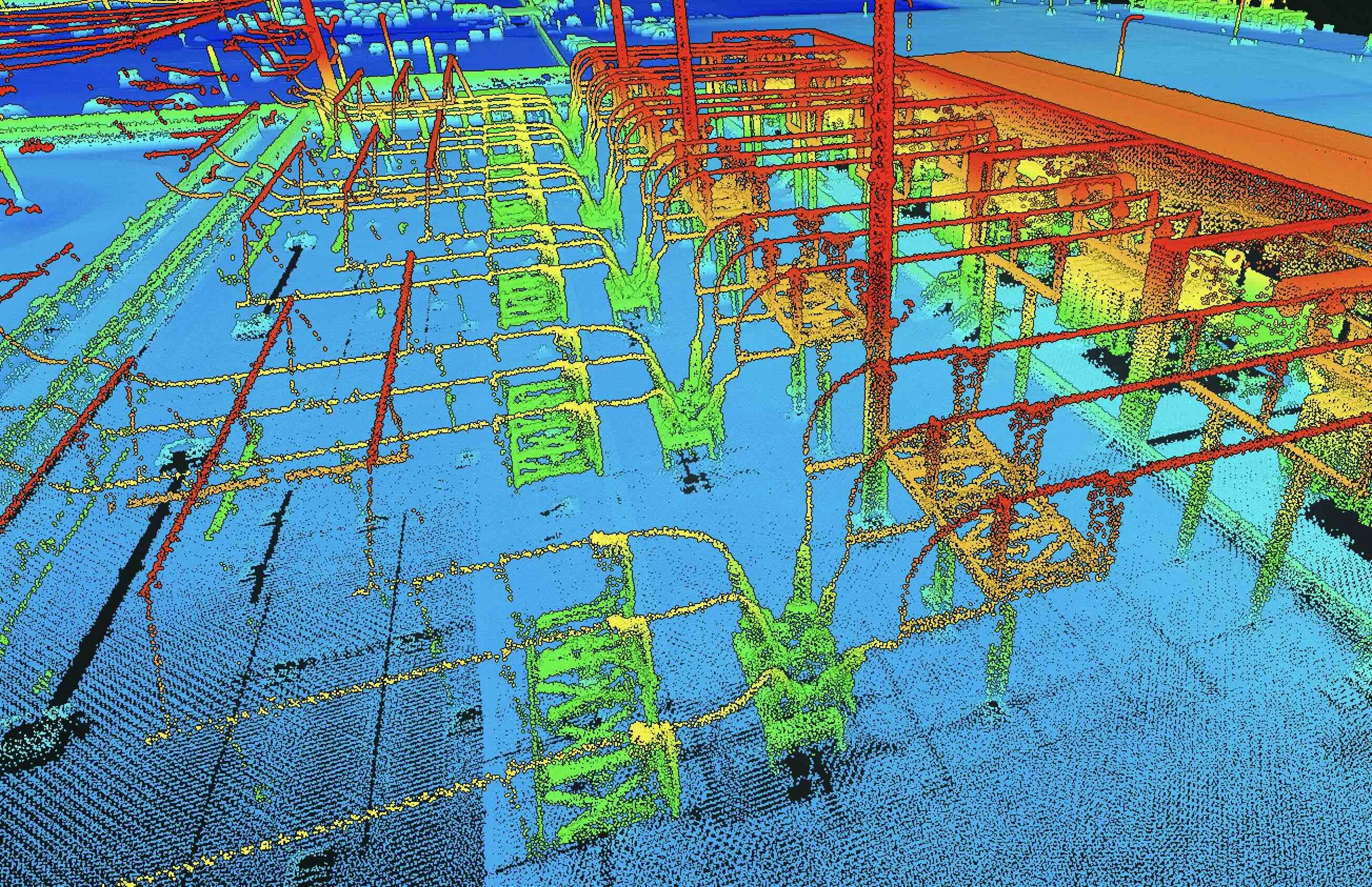
Digital Twins
Industrial firms use LiDAR digital twins & precise 3D models of large assets to inspect assets, extract measurements, monitor conditions, and more!


LiDAR PROJECT Samples:
Select a project below to explore our interactive point cloud viewer. For optimal performance, we recommend using Google Chrome on a laptop or desktop.
Game2Life: An engineering firm engaged our team to generate a detailed point cloud of the facility in advance of a planned expansion. The data was used to obtain measurements and to visualize elevation variations across the site.
3940 Palmetto: The property owner commissioned a site scan prior to making an offer on the lot. The resulting data supported due diligence efforts and informed the negotiation process.
Drainage Analysis: This developer requested a scan to visualize neighboring property drainage analysis prior to project start.
*Porche Aerial is not a licensed land surveying firm and does not offer surveying services. When survey-grade data or deliverables are required, we work in partnership with licensed professional surveyors to ensure full compliance with regulations.