ORTHO MAPPING
MaP-Driven Fields:
Engineering & Surveying
Environmental Services
Land Development
Oil & Gas
Energy & Utilities
Transportation & Infrastructure
Land Development
Government & Municipalities
Telecommunications
PHOTOGRAMMETRY
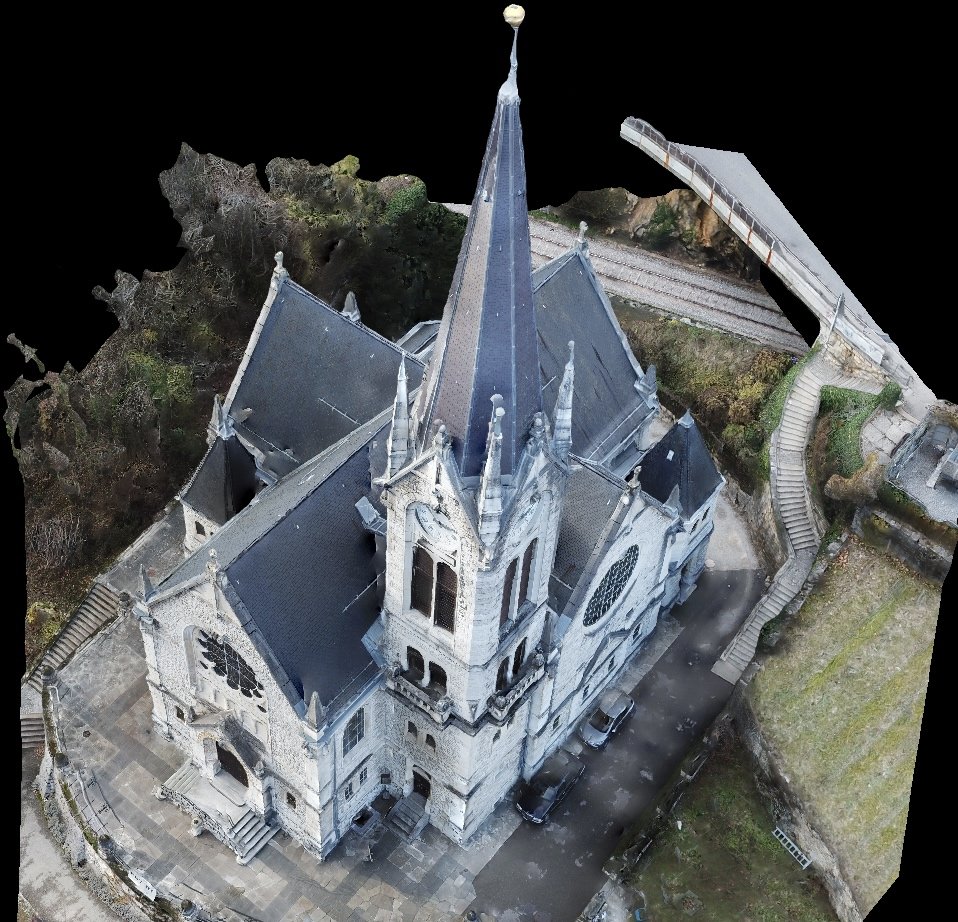
Imagine a drone flying over a site, capturing thousands of overlapping photos from different angles. When stitched together, those images create accurate 3D models and detailed maps. That is the power of photogrammetry.
Instead of laser pulses, photogrammetry relies on high-resolution imagery and advanced algorithms to measure depth and distance. By analyzing how objects appear across multiple images, it calculates precise spatial relationships and turns flat photos into detailed digital models.
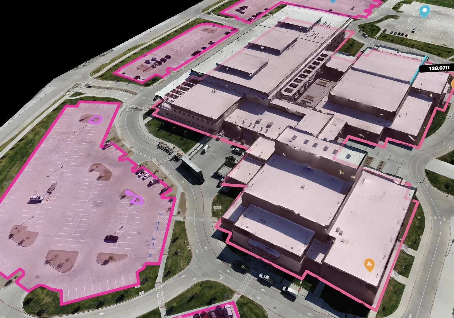
Photogrammetry is transforming aerial data collection by creating accurate orthomosaics, 3D models, and elevation maps using imagery alone. It is especially powerful in large-scale mapping, infrastructure inspection, land planning, and agriculture. It turns aerial imagery into actionable insight, offering a ground-level understanding from an overhead perspective.
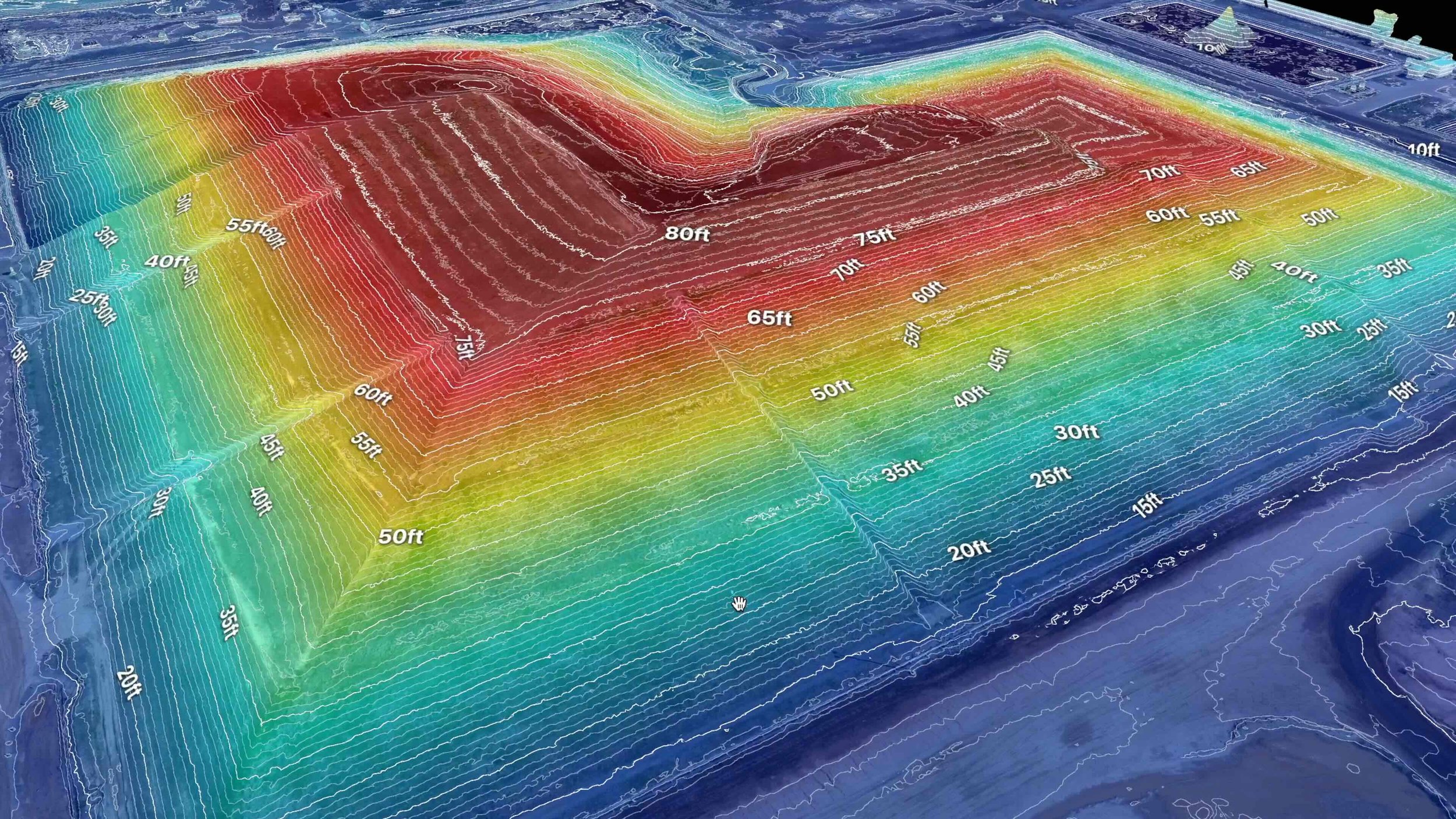
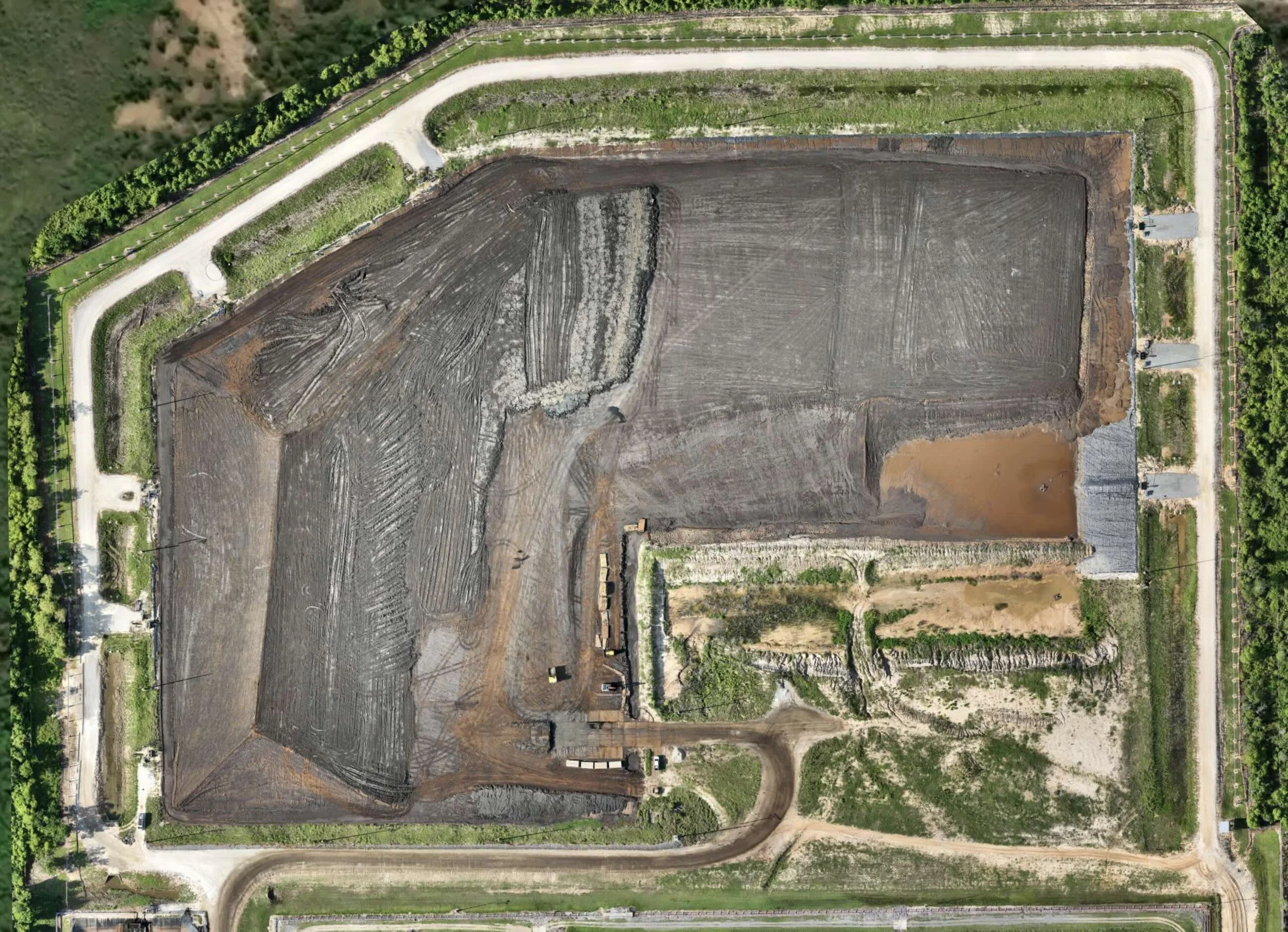
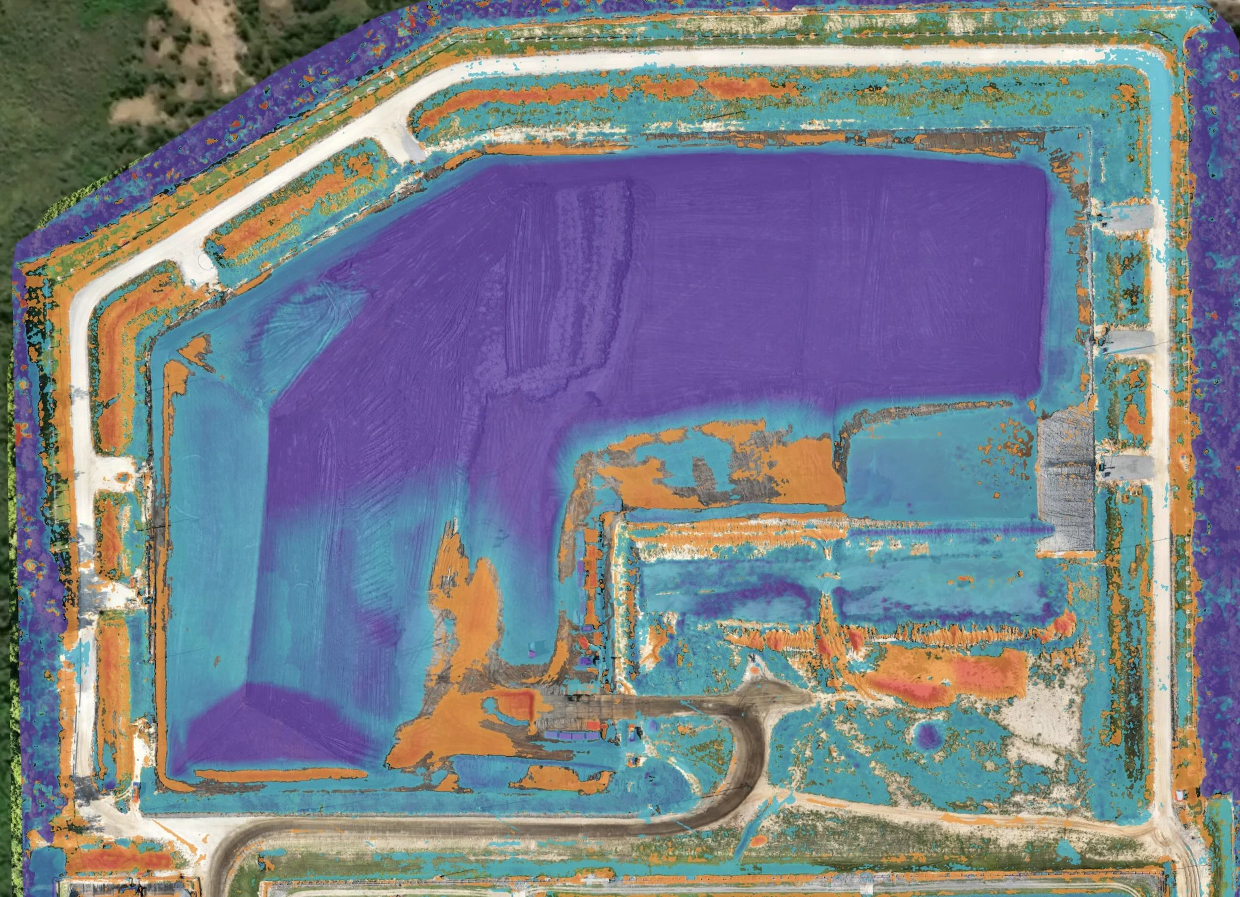
Explore the interactive sample below to see a real-world mapping project in action. Use the slider to view elevation spectrum data and cut/fill material movement. These insights are available to your organization today.
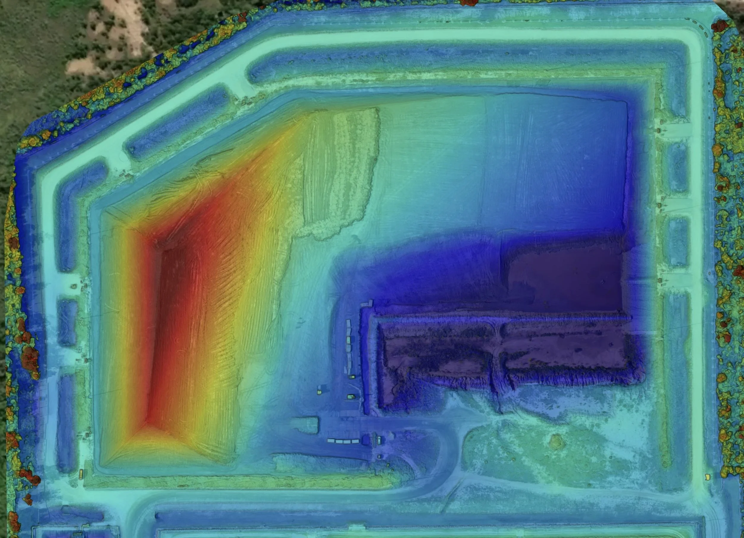
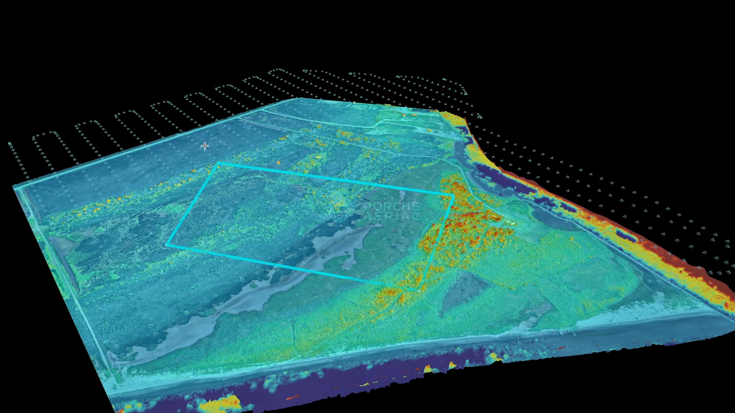
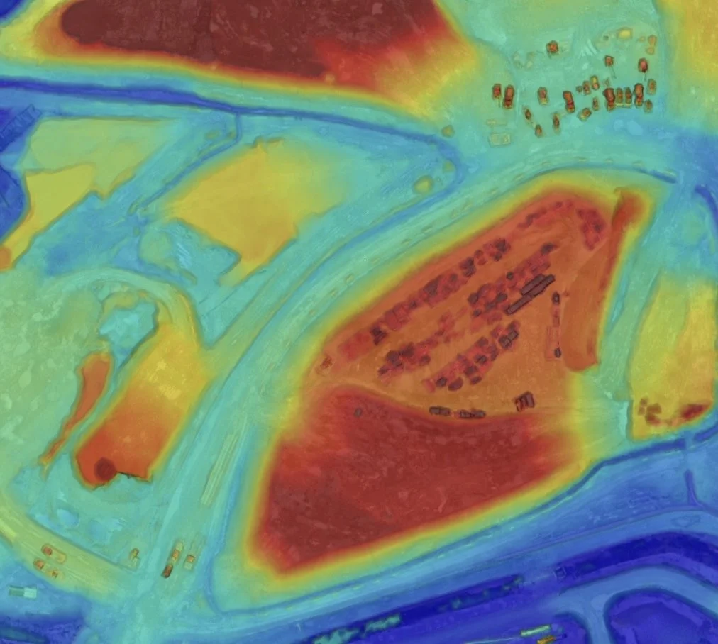
ELEVATION SPECTRUMS

CUT/FILL - MATERIAL MOVEMENT
EVERY
DETAIL.
One Complete view
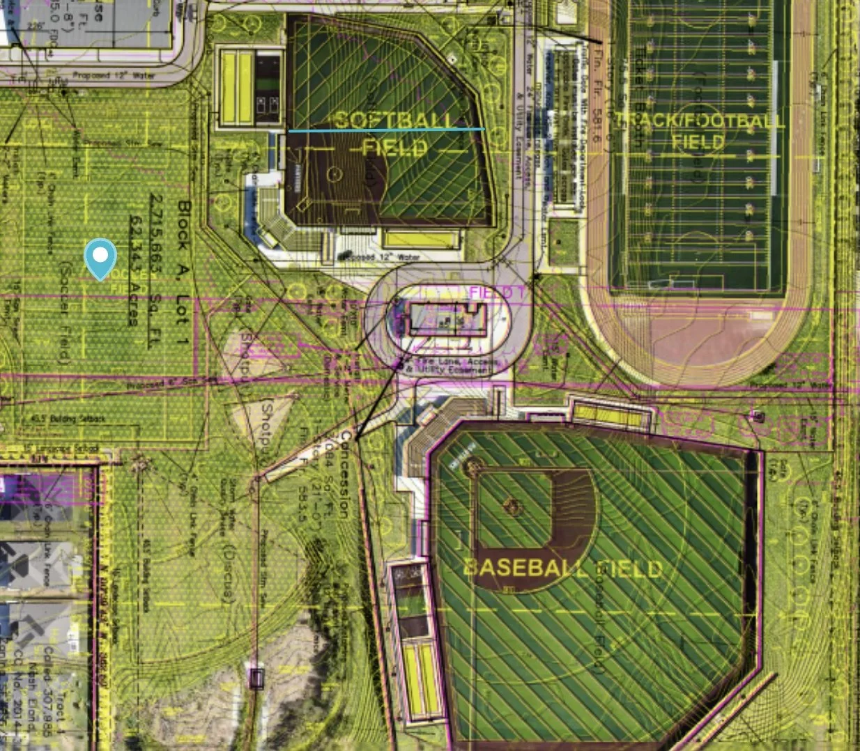
The value of advanced mapping lies in more than a single image. Multiple viewpoints and data layers allow teams to extract meaningful metrics from every project.
Orthomosaic: A seamless, georeferenced map created from thousands of overlapping images, accurate to real-world coordinates.
Visible (RGB): High-resolution aerial imagery aligned to scale, ideal for visual context and easy interpretation.
Digital Surface Model (DSM): An elevation model that includes buildings, trees, and other surface features.
Digital Terrain Model (DTM): A simulated bare-earth elevation model generated by removing surface structures.
Cut / Fill Analysis: A visual breakdown of material movement, showing where land was removed or added over time.
From elevation models to annotated overlays, these layers reveal critical details for planning, development, and review. Watch below to see a few examples of how we derive metrics from datasets.
FLY OVER.
MAP OUT.
PLAN AHEAD.
A smarter way to map: Photogrammetry gives you the clarity you need to make informed decisions. By capturing high-resolution aerial imagery and processing it into accurate orthomosaics and 3D models, we turn visuals into reliable geospatial data. It is a proven method for planning, measuring, and monitoring projects across construction, development, and land management.
Not a replacement — just a different tool: Photogrammetry and LiDAR are both valuable, but they serve different purposes. Photogrammetry is ideal for capturing visual context, surface detail, and accurate measurements when clear line of sight is available. LiDAR, on the other hand, uses laser pulses to penetrate vegetation and reveal true ground surfaces beneath. These tools are not in competition—they are often used together to provide a more complete picture.
Explore the possibilities: The video below shows how photogrammetry supports smarter project planning through multiple views, accurate measurements, and annotated overlays. From terrain evaluation to volume analysis, these tools help teams stay ahead at every stage of the job.
VIDEO: DRONE MAPPING
Turning drone imagery into accurate maps, models, and measurements.
FIELD APPLICATIONS
-
![Visual Progress Monitoring]()
Visual Progress Monitoring
Site owners use high-resolution orthomosaics to document construction stages and site changes over time.
-
![Asset Documentation]()
Asset Documentation
Record the current condition of roads, structures, and infrastructure from an overhead perspective.
-
![Surface Modeling & Site Planning]()
Surface Modeling & Site Planning
Create up-to-date 2D and 3D representations of visible terrain, structures, and access routes.
-
![Digital Twin Creation]()
Digital Twin Creation
Generate measurable 3D models of built environments for collaboration and virtual inspections.
-
![Stakeholder Reporting]()
Stakeholder Reporting
Provide clear, georeferenced imagery and context to support operational awareness amongst all teams.
*Porche Aerial is not a licensed land surveying firm and does not offer surveying services. When survey-grade data or deliverables are required, we work in partnership with licensed professional surveyors to ensure full compliance with regulations.